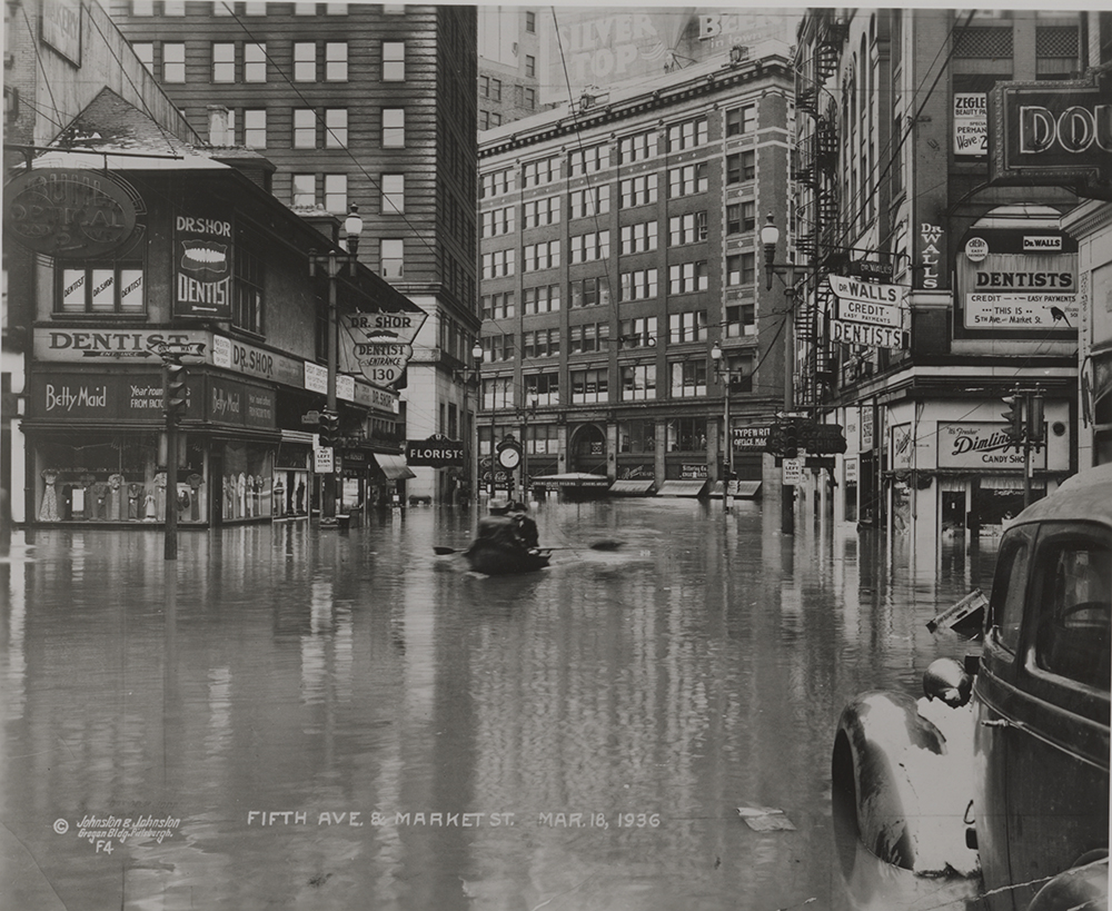
On St. Patrick’s Day in 1936, an unlucky downpour resulted in one of our region’s worst natural disasters.
Nearly two inches of rain fell on March 16, which added to the 63 inches of snow that came throughout the winter. Warm temperatures melted the snow, swelling creek beds along the upper Allegheny and Monongahela Rivers. On St. Patrick’s Day, the rising rivers reached the North Side and washed into the streets of Downtown, wiping out historic businesses within hours. River levels reached a peak of 46 feet at the Point, more than 20 feet over flood stage, leaving more than half of Downtown businesses underwater.
By the time the waters receded a week later, the destruction and devastation were almost unfathomable – 62 dead in the region, over 500 injured, 135,000 homeless, and millions of dollars in property damage to homes, businesses, and industries.
Perhaps best known are the pictures of a flooded downtown Pittsburgh, but the damage was felt far and wide – from Western Pa. towns like Johnstown, Sharpsburg, and Etna, all the way to the District of Columbia and 11 states across the Northeast and Mid-Atlantic regions.


The human and economic toll of the 1936 flood demonstrated the power of nature and made clear the necessity of change. The passage of the Flood Control Act in June of 1936 authorized the construction of a system of dams and reservoir projects by both the Army Corps of Engineers and affected communities.
Levels of the 1936 flood lines can still be seen on some buildings in downtown Pittsburgh.
See more images from our collections of this flood and others in the Pittsburgh region online at the Detre Library & Archives’ Digital Collection: Pittsburgh Floods.


Brady Smith is the Director of Marketing and Communications at the History Center.