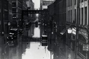
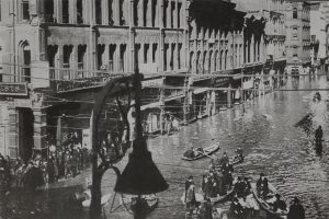
Pittsburgh Floods
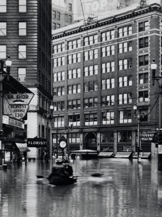
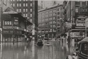
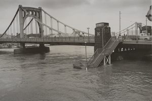
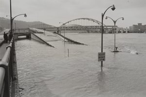
Pittsburgh can lay claim to many remarkable topographical features but among the most distinctive are its three rivers – Allegheny, Monongahela, and Ohio. These bodies of water converge to form a point delineating Pittsburgh’s downtown and creating what is known as the Golden Triangle. But living on the water is not without its hazards. With great rivers come great floods, and Pittsburgh has suffered through many in its history. The Detre Library & Archives collection contains photographs depicting numerous floods and their aftermath on the city and nearby communities, including those shown here from 1883, 1907, 1936, and 1964.
Over one hundred flood photos can be found in the archives, including those from the historic Johnstown Flood of 1889 and other throughout the years that have been documented by amateur photographers and journalists alike. Images of bridges over waterlogged city streets, rowboats in use for transportation and rescue, and submerged trains, homes, and businesses remind us not only of the fragility of our environment and our place in it, but of the resilience and compassion of everyday citizens as they assisted those in need and rebuilt again and again.
Collection Highlights
Further Research
Detre Library & Archives: Resources on Floods